Monday, June 4, 2018

Lejog day 2 - 6/4/2018

Today is Fowey to Moretonhampstead - the hardest single day on Lejog. We follow the coast to Plymouth then head inland on NCR 27 up and onto Dartmoor.

Here we all are at the pre-ride talk.


The approach to Plymouth was lovely.

Goat track

On the way to Plymouth

On the outskirts of Plymouth

Navigating through Plymouth was tricky and we were lucky to be in a group that included a rider who knew his way around. While we were waiting for a light we were accosted by an elderly woman in a Skoda who felt we were a menace. I couldn't actually tell what she was shouting through her three remaining tobacco-stained teeth but I kind of got the gist of it. I confused her by agreeing with her.

Lunch was at a pub followed by a ferry ride.


After Plymouth we got onto NCR 27 which was amazing. It reminded me of the bike path over the Vail Pass in Colorado.


Two of the more impressive riders were Liz and Mike. Liz was riding an electric assisted hand bicycle and Mike was on a regular electric assisted bike.

Liz

Once we got up onto Dartmoor the view was great. There were still a lot of climbs even on the moor. There were sheep and ponies browsing by the side of the road and it was a bit scary flying down the hills knowing that they could decide to cross the road right in front of you.


This was now the toughest 100k I had ever ridden. Yesterday's record didn't last long. We rode 64.9 miles with 6368' of climbing. Wow!

Lejog day 1 - 6/3/2018

Today is 62 miles from Land's End to Fowey. Here are some of the other cyclists in our 25 rider group.


Eventually David got Amber's brakes working correctly and we set off towards Penzance.

Footpath to Penzance

We had a strong headwind and a spot of rain before we got to Penzance.


Just after passing through Penzance we passed near St. Michael's Mount.

St. Michael's Mount in the distance

Ferry over river Fal
After the ferry we turned inland and started some major climbing. It was probably the hardest 100k I've ever ridden.Tomorrow was supposed to be harder.

There were many interesting things to see such as this miniature horse and cart.


A combination of dehydration, low electrolytes, and extreme exertion gave me some serious cramps. But I did enjoy the downhills. Here is a video of us passing through Par.


I had the nose of my saddle too high and the rivet at the front caught on my pants as I tried to dismount which ripped a huge hole in them.When we got to Fowey around 6 pm I went and found a SportsDirect and bought a new pair of shorts for about half the normal price. They weren't the best shorts I've ever owned, but they did the job. I also dropped the nose of my saddle.

All in all it was a very tough day, but the scenery was wonderful and Peak Tours really worked hard for us. Total trip distance was 65.7 miles with 5179' of climbing.

Saturday, June 2, 2018

Day before Lejog. 6/2/18

Amber and I are poised to ride land end to john O'groats (lejog) starting tomorrow. It's 1000 miles in 14 days with lots of climbing. We're currently in st. Just about 6 miles from the start. We had a wonderful cream tea at the cook book cafe today. It was incredibly good and ridiculously good value.

Tomorrow we all ride to land end to start the first day which ends in fowey which is pronounced fow. We're on rented bikes so we ride to  landsend and back today to try to dial the bikes in a bit.

We're off to the hotel across the road now for a pre ride meet and greet. Hopefully we can someone to fix the brakes on ambers bike because they're not very good.

David, the ride leader, rode Amber's bike and agrees the new rear brake pads aren't working properly. He's going to get someone to buy some new ones and replace right before the ride.

Footpath at St Just

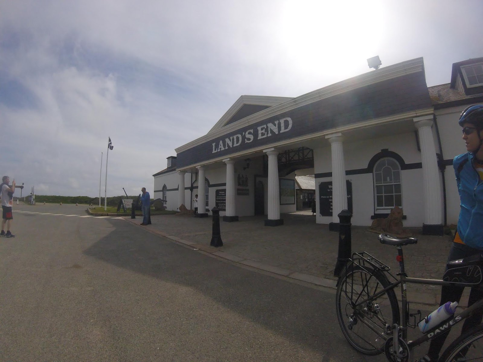
Entrance to Land's End

Friday, May 11, 2018

How much external battery do I need?

Like most long-distance cyclists I need an external battery pack to power my navigation device for the duration of some of my rides. I recently lost mine and bought a new one on Amazon. Like an idiot I just went for the one with the largest capacity. When it arrived it was the size and weight of a brick (21.5oz) - much too heavy to lug around with me all day.

So I decided to actually think about it and determine how much capacity I really need. These are the numbers that are relevant.

Ci = Capacity of my navigation device's internal battery
Di = Duration of my navigation device using its internal battery
Dt = Total duration I need

My navigation device is a Galaxy Note 4 which, according to the specs, has a capacity of 3220 mAh
The last time I tested it the device ran the rwgps app for 6 hours from a full charge down to 10%
The longest I can conceive of riding between charge opportunities is 27 hours for the hypothetical 400 km from hell.

Therefore I need an external capacity of...

Ce = (Dt - Di) * Ci / Di = (27 - 6) * 3220 / 6 = 11270 mAh

So that brick, with it's capacity of 30,000 mAh, was serious overkill. It would power my Note 4 for another 55 hours for a total of 61 hours approximately between charges.

Anyone want to buy a brick?

Sunday, May 6, 2018

California Coasting Public Ride

On the 28th and 29th of April we ran the California Coasting 600 km and 400 km brevets. The turnout was about double what I expected with a total of 34 riders setting out from beautiful San Luis Obispo at 5:00am. The weather was perfect and we had predictions of a very strong tail wind.


Kerin Huber went on ahead to staff the secret control at mile 10 and the first receipt control at Santa Maria. Our Canadian friends showed up super fast and Pete, our nominal lantern rouge, came through surprisingly quickly. 

I waited at my hotel room for an hour for late comers, of which we had none, then headed over the the Cowgirl Cafe next door for my breakfast. Then I drove a little south and jumped on my bike to try out the Bob Jones bike trail that goes to Avila Beach.

Entrance to the Bob Jones bike trail

Avila Beach


Once I got back to my car the pack was spread out enough to warrant having two SAG vehicles and I drove on along the route towards the second receipt control at Los Olivos. I picked up the back of the pack as I approached Los Alamos and had a chat with Pete as he refueled there. I saw several more riders along the 135 and there was quite a large group already at Los Olivos when I got there. Everyone agreed the R Market was an ideal place for a control. I stayed there until Pete showed up.


From Los Olivos I headed down the course to Ballard Canyon and on to Buelton and Santa Rosa road. We had a head wind on Santa Rosa road during the staff ride but it was twice as strong during the public ride and riders were glad to finally get to Lompoc where they could turn around. I'm glad I was driving!

The bike path approach to the Lompoc control was a big hit - much better than riding on Ocean and 6th Street.

The hardest climb on this route is from Lompoc over the Gaviota Pass. Even with a strong tailwind it's a long climb. Fortunately it wasn't too hot. I drove back and forth along this section of highway 1 several times making sure all my riders were doing OK. The last rider (guess who - no actually it was Mel) came over the top around 4pm. This point is about 120 miles into the ride - slightly more than half way to the overnight control.


After the top of the Gaviota Pass there is a very fast descent to the 101 and then on down to the coast at Gaviota state beach. From here on to Goleta we ride on the shoulder of the 101 with a powerful tailwind all the way to Santa Barbara. From Santa Barbara I drove to the overnight at Moorpark and then back to Port Hueneme where I waited with food for riders that missed the Wendy's control. While I was there, Stacey called to say she was DNFing at Mussel Shoals. I picked her up and took her to Camarillo. By the time I got back to Port Hueneme most of the riders were through. I ended up giving a muffin to a homeless woman which seemed to confuse her.

Can you see me now?

I saw Mel and Pete through and headed up to the overnight at Moorpark again. I think we all appreciate what a wonderful job Lisa and Greg did of providing hospitality at their house. I hadn't eaten since Lompoc about six hours earlier and those roast potatoes and mac and cheese were awesome. I can only imagine how good they tasted to those who had cycled 225+ miles to get here.

After a few hours sleep in my car I drove along the course towards the end at San Juan Capistrano. Some of the super fast riders had arrived before the room was available so Tim sat with them in the lobby until a room became available. Definitely one of the disadvantages of a point-to-point.

Tim and I waited at the end for the riders to arrive. I fully expected to be called out to pick up more DNFs but everyone who started the second day finished it, even those who rode right through. Congratulations to all of you. We only had two DNFs out of the whole group.


Photographs courtesy of Terry Hutt and Lori Arita.

I'm thinking of taking the first day of this ride and creating a 400k from it for next year. I'll make a point of hitting the scenery harder and ending at Camarillo. I'll go to Morro Bay and Avila Beach, use Foxen Canyon instead of the 135, and route through Hope Ranch in Santa Barbara. Maybe something like this https://ridewithgps.com/routes/27375582. It'll still have the headwind into Lompoc and the climb out, but it should be a good PBP year ride with some logistical issues and about the right amount of climbing.